Cows in Exmoor

Exmoor National Park

Designated on 19 October 1954

A wild landscape of windswept coast and woodland, a living map of agricultural and industrial history, a quiet place of simple villages, a playground of the rich. Exmoor is all of these, with a diversity of terrain, people and wildlife which offers a huge breadth of experiences for visitors. Walk with wild ponies, relax in fabulous pubs, swim in lidos and stroll the halls of country houses that track the centuries in every stone.

Walking

Watersmeet from Lynmouth (NORTH)

Start/endpoints: Lynmouth

Watersmeet from Lynmouth (NORTH)

Start/endpoints: Lynmouth

Distance: 3.5 mi, elevation: 700ft, Difficulty rating: 2

Start/endpoints: Lynmouth

This might just be the perfect gorge walk. A forested climb in dappled light by the rushing river leads you to Watersmeet House at the halfway point, where you can stop for tea and cake before wandering back down. It’s slippy in places, where rocks and tree roots intrude on the narrow path, but by no means demanding physically, if you take it slow and keep your mind focused on your “half-time scone”. Every so often along the way, you catch sight of the sea sparkling between the trees and there are regular viewpoints where you can emerge from the trees to look out over the sparkling coast. When you get back to Lynmouth, you’ve got several choices for a pub lunch and you can complete the descent from cliffs to sea level by heading right down to dip your toes in the waves.

Watersmeet, Image by Neville Stanikk via Exmoor Commons

Mountain goats on the road in Valley of Rocks, Exmoor

The Valley of Rocks (NORTH)

Start/endpoints: Lynton

Mountain goats on the road in Valley of Rocks, Exmoor

The Valley of Rocks (NORTH)

Start/endpoints: Lynton

Distance: 5 mi, elevation: 980ft, Difficulty rating: 3

Start/endpoints: Lynton

If you don’t know this place, you’d be forgiven for wondering what the fuss is about. Most valleys have some rocks in them somewhere, after all. But when you see the spurs of stone reaching out from the cliffs like grasping fingers, and angular slabs piled on top of each other, the name takes on a more majestic feel. In and around this striking landscape, the highest sea cliffs in England, feral goats scramble, seabirds soar and dolphins and seals break the waves. It’s a visual treat wherever you look. There are several routes through the valley, from a two-mile wander along the floor to the five-mile circular that starts from Lynton and carries you up through heather and woodland, past Lee Abbey and onto the eponymous ridge.

Valley of Rocks © Harriet Gardiner

Dunkery Beacon in Exmoor

Dunkery Beacon (NORTH)

Start/endpoints: Dunkery Beacon car park

Dunkery Beacon in Exmoor

Dunkery Beacon (NORTH)

Start/endpoints: Dunkery Beacon car park

Distance: 2.5 mi, elevation: 1350ft, Difficulty rating: 2

Start/endpoints: Dunkery Beacon car park

The summit of Dunkery Hill, Exmoor’s highest point, is not only a wonderful place to look from, but also to look at. In summer, while the peak gives you views all the way to the English channel one way and the glittering ribbon of the Bristol channel the other, the slopes themselves become covered in a carpet of purple heather. The walk up is a steep climb but it certainly won’t challenge your navigational skills, as the path is a clear triangle cutting through the hillside and you start from a car park with the peak looming above. Walking the shorter edge, which starts just up the road from the car park, reduces the distance by about a mile but if you prefer not to retrace your steps and want a gentler climb, veer off left at first and approach the pointed cairn from the west.

Dunkery Beacon © Katja Pesari

The Chains (WEST)

Start/endpoints: Siding off B3358 near turning for Pinkery Centre

The Chains (WEST)

Start/endpoints: Siding off B3358 near turning for Pinkery Centre

Distance: 5mi, elevation: 580ft, Difficulty rating: 3

Start/endpoints: Siding off B3358 near turning for Pinkery Centre

Heading off to one of the less-travelled areas of the park gives you emptier trails and a wilder experience, as you turn away from Exmoor’s famous coast and embrace its moody moorland. Depending on the conditions, it might well embrace you back. Parts of this walk go through peat bogs that will happily eat your boots, but the reward is a view from almost the height of Dunkery Beacon and what you pass along the way. There are ancient burial mounds, the swimming spot at Pinkery Pond and the site at Moles Chamber where the Acland Arms once sat, with its remote location making it a perfect haven for smugglers. This isn’t an easy walk, so go well armed with navigational tools and spare socks, but the feeling of really being deep in the moors makes it all worthwhile.

Chains Valley Image by Shaun Davey via Exmoor Commons

Winsford and punchbowl (CENTRAL)

Start/endpoints: Winsford

Winsford and punchbowl (CENTRAL)

Start/endpoints: Winsford

Distance: 5mi, elevation: 1200ft, Difficulty rating: 3

Start/endpoints: Winsford

It wouldn’t be a guide to rural England without a visit to some devil-inspired geographical features. Ever the busy landscaper, Old Nick’s work on Exmoor got him so thirsty he dug out a well to drink from, creating both the punchbowl and Dunkery Hill in the process, as he threw the earth he’d removed over his shoulder. The village of Winsford itself is a lovely place to wander round and has a lovely pub at which to start, end or ignore the hike. The route is well-signed and consists mostly of a steady climb that gives you better and better views down into the punchbowl as you rise. With some deep gullies, tree boundaries and swathes of open moorland as well, it’s a mini tour of Exmoor’s pastoral beauty.

Bossington Hill Image by Shaun Davey via Exmoor Commons

Dulverton to Tarr steps (SOUTH)

Start/endpoints: Dulverton

Dulverton to Tarr steps (SOUTH)

Start/endpoints: Dulverton

Distance: 12mi, elevation: 2000ft, Difficulty rating: 4

Start/endpoints: Dulverton

While obviously not the quickest way to get to Tarr steps, this is a fantastic long-distance walk that sets the medieval bridge over the River Barle as the midpoint. After leaving Dulverton, you cross Barle Bridge, itself a relic of the middle ages, with its five stone arches looking good for their age. From there you simply follow the river, passing by the Iron Age Hillfort at Brewer’s Castle before forking off to reach Tarr steps. The distance and several climbs make this a fairly challenging route, but once you’ve dipped your hot feet into the waters by the iconic slab bridge, you’ll be ready to head back and stop at your final bridge of the day, Dulverton’s Bridge Inn.

Tarr Steps © Harriet Gardiner

Other things to do

The incredibly varied history of this place begins with a Norman hillfort and leaves marks from many centuries on the present site. There are massive iron-bound doors from the 1200s, a medieval bastion tower (which itself lies in ruins after Cromwellian disapproval), and the ornately carved staircase installed in the late 1600s when the Luttrell family began its transformation into a lavish family home. You can tour the house and also see the working watermill (a rare double overshot model, for the connoisseurs), from which you can take home a bag of flour ground at a place recorded as a mill in the Domesday book.
You might think we’ve sneaked another hike into this guide, but the Tall Trees Trail is really just a good reason to pick one part of woodland over another and take a lovely stroll in it. To reach England tallest tree from the carpark on Broadwood Road near Dunster will only take you a couple of minutes but the Douglas Fir, around 200ft high, is quite a sight. Once you’ve admired it and some of the other tall trees that surround it, you can extend the walk further into the woods or up nearby hill Bat’s Castle, then return to Dunster for lunch, or even breakfast if you made an early start to the day!
In 1881, a local newspaper, The Lynton and Lynmouth Recorder, received an anonymous letter suggesting that the two towns, separated by 900ft of cliff but almost no lateral distance, be connected by a funicular railway. For four years, it remained nothing more than a curious idea, until the noble and public-spirited John Heywood got involved. He began to source funding and support for the railway and promenade that would be constructed right next to land he had coincidentally recently purchased. After the overcoming of many challenges and thanks to some incredible engineering ingenuity, the first cars rattled up and down the track in 1890. Aside from some maintenance closures, it has operated continuously ever since, just as it runs every day. There’s no timetable, so roll up when you’d like to zip up or down the cliff and wait for the next ride.
Of the roughly 16,000 churches in England, St Bueno’s near Culbone is said to be the smallest. Dedicated to a 7th-century abbot, it’s unclear exactly when it was built, with some estimates dating parts of it back to the 11th century. Accessible only on foot, taking about half an hour from parking spaces near Silcombe Farm off the A39, it’s a truly peaceful place in which you can imagine the community of Welsh monks who settled here were extremely content. You can wander in to have a look around and, while the tour won’t take up much of your time, you’ll come away with a feeling of quiet contemplation inspired by both the setting and the solid little building itself.
On a sunny day, walking the moors can get seriously hot, with a dip in the water the perfect antidote. Cow Castle, about an hour’s walk from the town of Simonsbath, is a lovely pool next to the ruins of the old defensive walls. On the way there, you pass Wheal Eliza, failed mine and site of an infamous murder in the 1850s, trekking woodland paths and open countryside to the watering hole. On the way back, take in a watering hole of another kind, with a stop at the Exmoor Forest Inn. If you’re hugging the coast on your trip to Exmoor but still fancy a safe swim, try Woody Bay, no less storied or beautiful. It appears to be a natural tidal pool sandwiched between imposing cliffs, but was in fact created by a Victorian entrepreneur, Colonel Benjamin Greene Lake. His grand plans to turn the area into a holiday resort were put on hold for 10-12 years while he went to prison for fraud, but the pool remains.
Exmoor Dark Sky Reserve was the first of its kind in Europe, harnessing its naturally low light pollution to create a protected area that’s not only great for nocturnal wildlife, but for visitors too. You’ll do fairly well setting up on any part of the moors and taking in the view, but local experts have a couple of favourite spots – Brendon Common and Porlock Common, where the flatness of the land and remoteness of the sites gives uninterrupted views in every sense. If you don’t fancy hauling a telescope around with you for your whole trip, you can hire one from any of the three National Park Centres at Dulverton, Dunster and Lynmouth and take it out onto the moors for a night of spectacular viewing.
Elsewhere in this guide, we laid out a 12-mile walking route to this ancient monument, but if you’d rather skip the opening bars and jump straight to the bridge, it’s easily done as there’s a car park a quick stroll through the trees. The “steps” are in fact an almost continuous span of slabs of rock, laid on stone pillars to create what’s known as a “clapper” bridge, of which it’s the longest remaining example in Britain. The name clapper derives from old Anglo-Saxon through Latin and means, roughly and somewhat prosaically, “bridge” and/or “pile of stones”. It’s an atmospheric spot and one in which it’s pleasant to linger, daydreaming about the many people who’ve crossed the river here over the centuries.
If you walk on the moors for long enough, at some point you’ll see some of the Exmoor ponies, eyeing you cautiously from a distance. While they’re often called “wild”, all of them are owned by someone, with about 20 herds ranging over various parts of the moors. They certainly aren’t tame though, so if you want to meet one up close, book a visit to the Exmoor Pony Centre. Established in 2006 as the permanent base of the Moorland Mousie Trust, who protect and promote the welfare of the ponies, it’s an informative, educational place where you can learn about the fascinating animals and their place in the ecosystem and culture of the area. More importantly, you can scratch one behind the ears and go for a ride as well.

DID YOU KNOW?
There are two elegant but unassuming benches in the town of Winsford, with plaques reading, “PRESENTED BY H.E.SELIGMAN ESQ. MAY 25TH 1939.” They were dedicated by and to members of a remarkable family, whose story is a dramatic one of fight from persecution, building an empire, then helping children escape Nazi Germany.

Liberator Memorial or Monument on Porlock Marsh, Image by Shaun Davey via Exmoor Commons

DID YOU KNOW?
Exmoor’s Hangman Cliff, near Combe Martin, is the highest coastal point on the British mainland, at around 1000ft. Local legend tells that the name derives from an unfortunate shepherding accident involving a hog-tied sheep, but it’s more likely a fusion of old Welsh and Germanic languages meaning, with a disappointing lack of whimsy, “sloping hill”.

Little Hangman from Great Hangman on Girt Down Image by Shaun Davey via Exmoor Commons

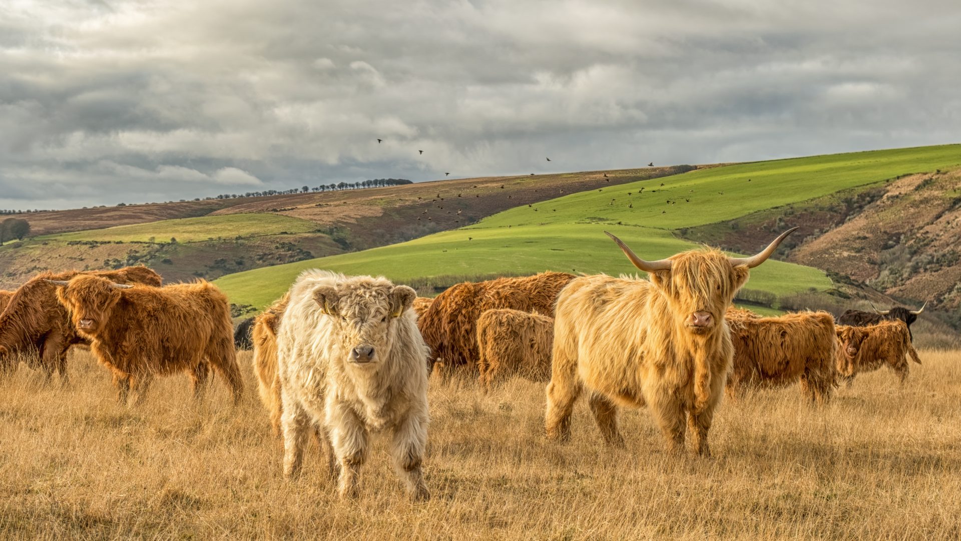
A QUICK HISTORY LESSON

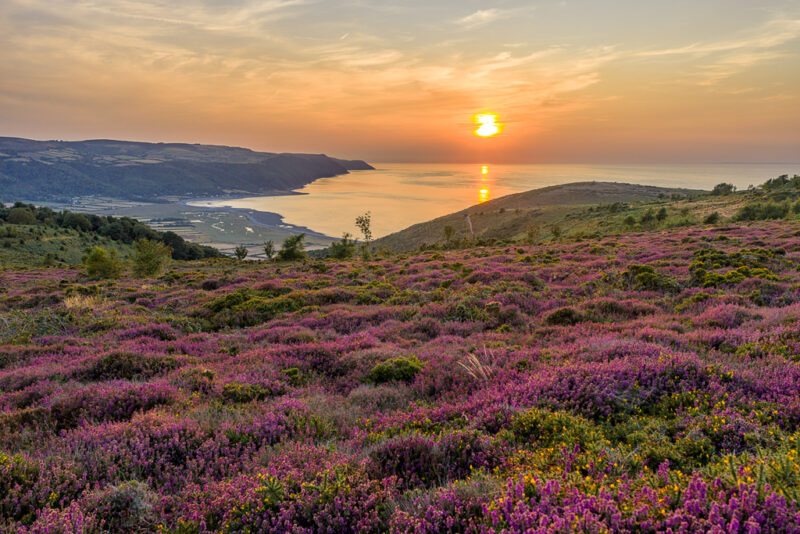
During the Second World War, thanks to pressures towards farming expansion created by food supply issues, huge acreages of moorland were ploughed and planted with crops. By 1954, when the area was designated a National Park, only 40% of true moorland remained intact. It was the chief concern of the newly formed authority that they retain as much of that as possible and they have been largely successful in preventing loss on a great scale. A change in farming subsidies that put the emphasis on the amount of land owned and not its produce could threaten even more of the original moorland habitat, but there’s a careful balance to be struck. Grazing animals are an essential part of the moorland ecosystem, so curbing all farming isn’t the answer. Exmoor has been lived on and worked by people in many ways for many centuries, and while the demands on the land change, the principle remains the same – to find a solution that works for everyone and preserves all aspects of the region’s history and culture.

DID YOU KNOW?
A Dodo was once steward of Exmoor. Yes, along with Almer and Godric, someone named Dodo is listed in the Domesday book as a “forester of Widepolla”, a rank which gave him control of the area which would eventually become Withypool. He is now, of course, very dead.

Oystercatchers in Porlock Marsh, Image by Shaun Davey via Exmoor Commons

Planning your visit

Rail transport into the park proper is limited, with Taunton in the east and Barnstaple in the west being the nearest stations. If you time things right, you can get from Taunton to Minehead via the West Somerset Railway, the longest heritage railway in England, but otherwise buses serve most towns and villages. Many of the most famous features and larger towns of the park are on the coast, so things tend to be a bit more accessible there, but if you’re after a wilder experience, head deep into the interior! There’ll still be a lovely pub when you need one.
Many of the famous trails are so clearly marked you’d be hard pressed to get lost, but there are precautions to take if you go for something a bit more off-road. While Exmoor isn’t mountainous, weather conditions can still shift in an instant and, because this is boggy moorland after all, footing can be treacherous in places. Plan your routes carefully, wear your best waterproof footwear and tie your laces tight!

Back to all National Parks


Main image: © Shaun Davey