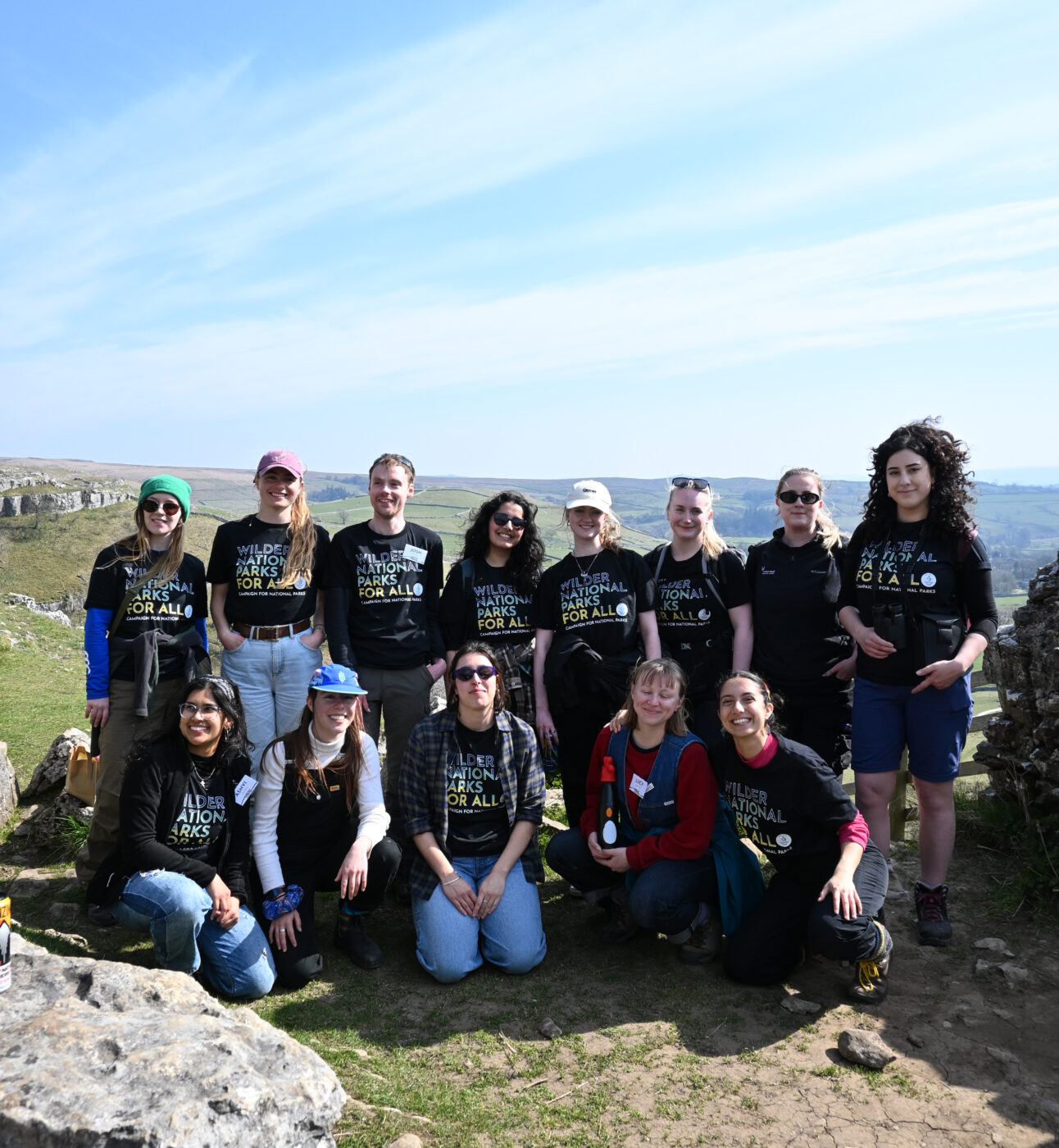
Our 2025 Highlights
While 2025 may have been a difficult year for nature, our supporters have enabled us to rise to the challenges and carve out some significant wins for National Parks.
Published: 26 June 2025
I don’t know about you, but I love poring over a map and dreaming of what’s possible.
I haven’t walked from John o’ Groats to Land’s End yet – but it’s on my list. If you love long walks, chances are you’ve either thought about doing it or already have. Most people aim for a fairly direct route.
But me? I’d rather take the scenic way – wandering through all of Britain’s breathtaking National Parks and the world’s first National Park City.
Wouldn’t you?
It would be an unforgettable journey.
More than that, a trail linking all our National Parks could be a powerful symbol – one that threads together not just landscapes, but people, places, and the very fabric of our nations.
It would offer all the benefits of a strategic long-distance route – boosting joy, wellbeing, creativity, connection, hopes and dreams all while spreading investment through local economies. And it would help us imagine a better-connected landscape – not just for people, but for the rest of nature too.
And here’s the best part: most of the paths already exist.
All we need to build a prototype trail is time, love and sandwiches.
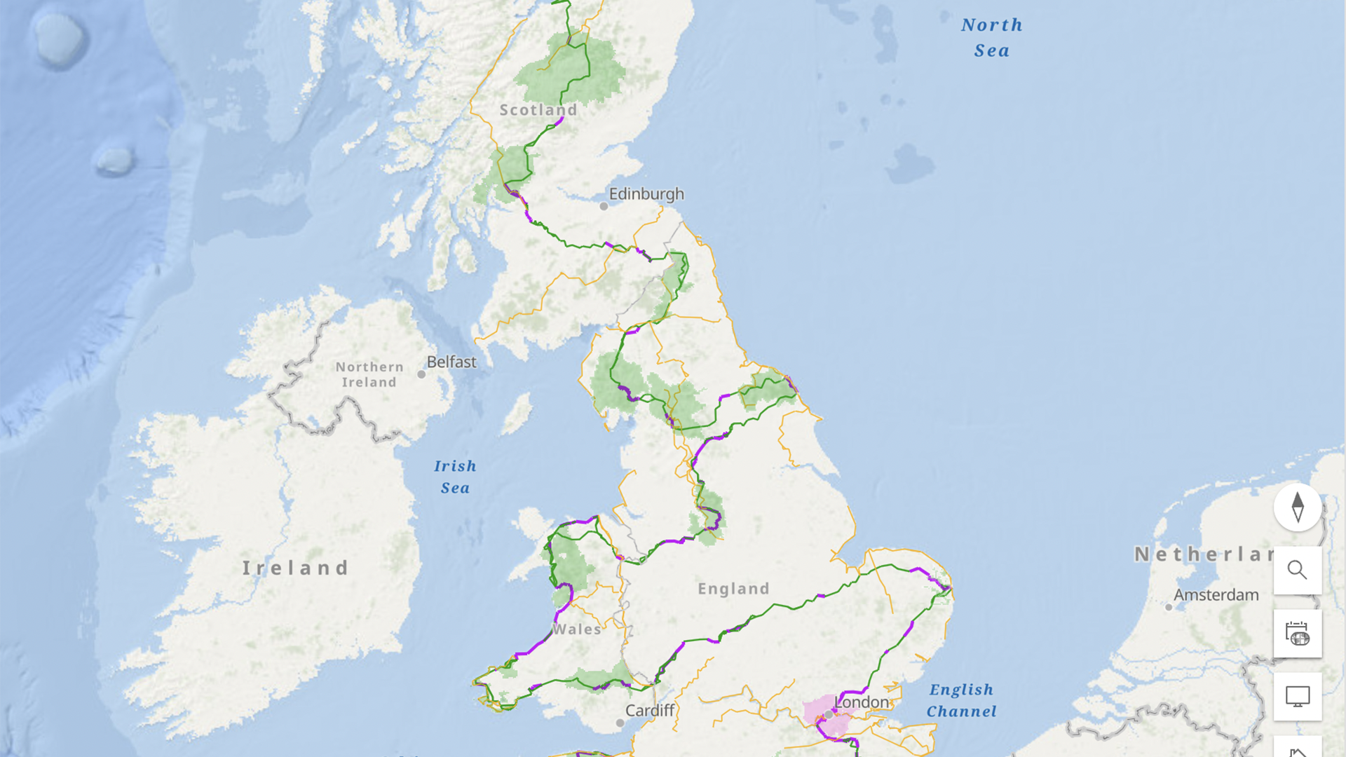
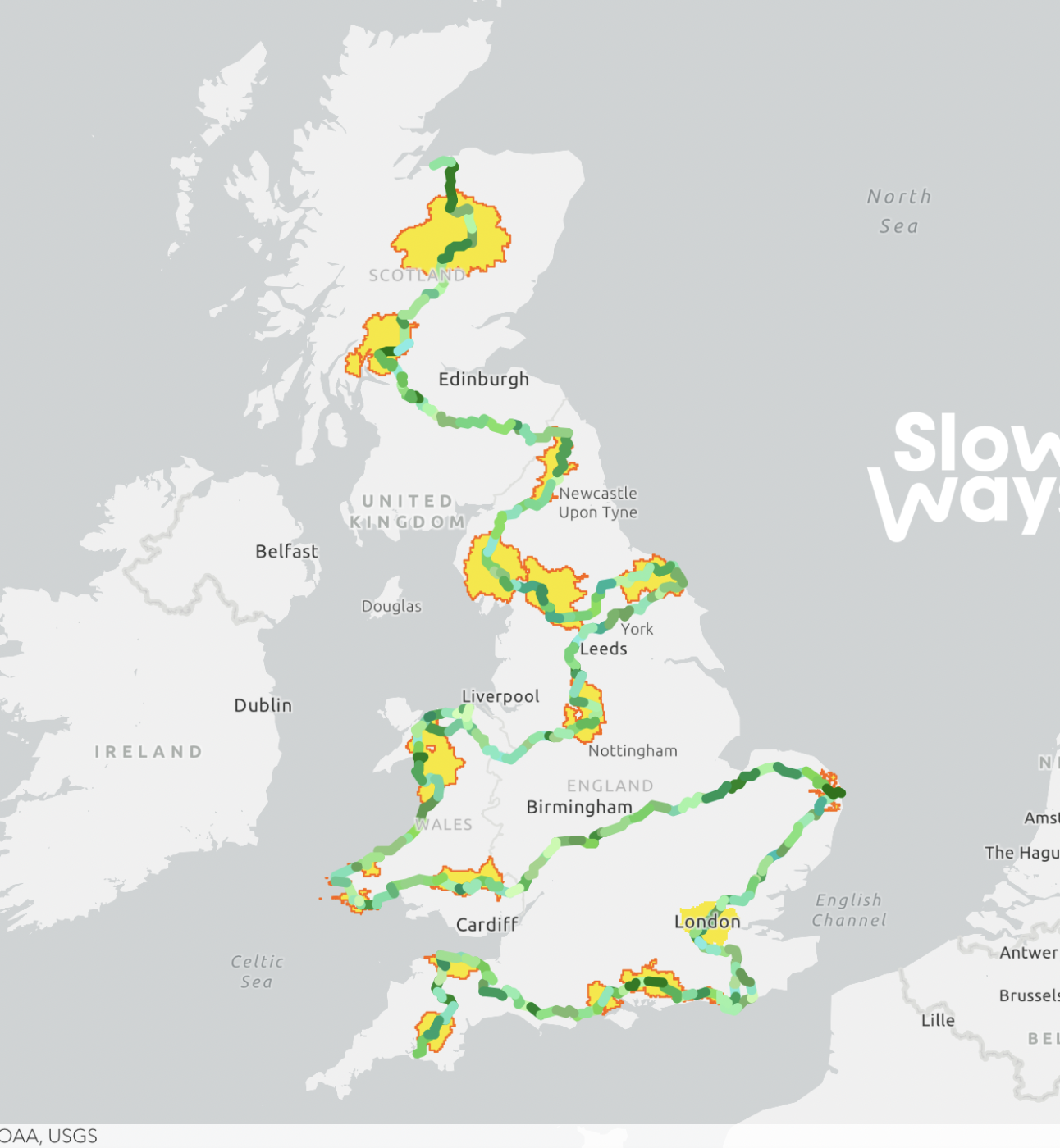
Back in 2020, I started Slow Ways, a grassroots initiative to create a national walking network. Since then, volunteers have mapped over 140,000 km (90,000 miles) of possible walking routes connecting all of Britain’s towns and cities as well as all our National Parks and nearly every National Landscape.
It’s a giant citizen geography project. Routes are suggested, checked, reviewed, and verified by people like you. Thanks to that shared effort, it’s now possible to walk between most towns and cities as well as all of our National Parks using routes rated 4 or 5 stars (the highest rating we give).
Using this existing network, a team of volunteers has mapped out a draft National Parks Trail. Many more are out exploring and checking it this summer – testing the route on the ground and helping bring the idea to life.
The current draft is 4,000 km (2,500 miles), starting in Nairn above the Cairngorms and finishing in Plymouth, just below Dartmoor.
It’s made up of 277 route segments. Each one averages 14 km (9 miles) and begins and ends in a village or town – so there’s usually a place to eat, sleep, or catch public transport.
Walk around 20 km a day, and you’d complete the trail in roughly 200 days. Starting in the south in spring and finishing in the north by autumn sounds like a pretty magical way to complete the journey while following the changing seasons.
Of course, not everyone would do it all in one go. Many would walk it in sections – over a number of years.
And while it might start life as just a line on a map, what if we developed it further? With great wayfinding, stories, interpretation – and fully accessible options too?
What if it became an official National Trail – linking not just National Parks, but existing National Trails as well?
Naturally, such a trail would need to be co-designed with local people, experts and authorities. But this version of the route is a trail in its own right – and a spark for imagining what’s possible.
We’d love your help shaping and sharing it.
Many will have strong opinions about where it should go. That’s good. We need discussion, ideas and local knowledge. The design process must be iterative, evolving, and participatory.
Verifying the proposed trail – within the framework of the Slow Ways network – creates a walkable route people can use now while inspiring improvements and alternatives for the future.
Our goal is to have a full version of the trail fully walked, reviewed, and verified by the end of August 2025.
With your help this is completely achievable.
Could you walk and review part of the route? Know someone who might? Tempted to take on the whole thing?
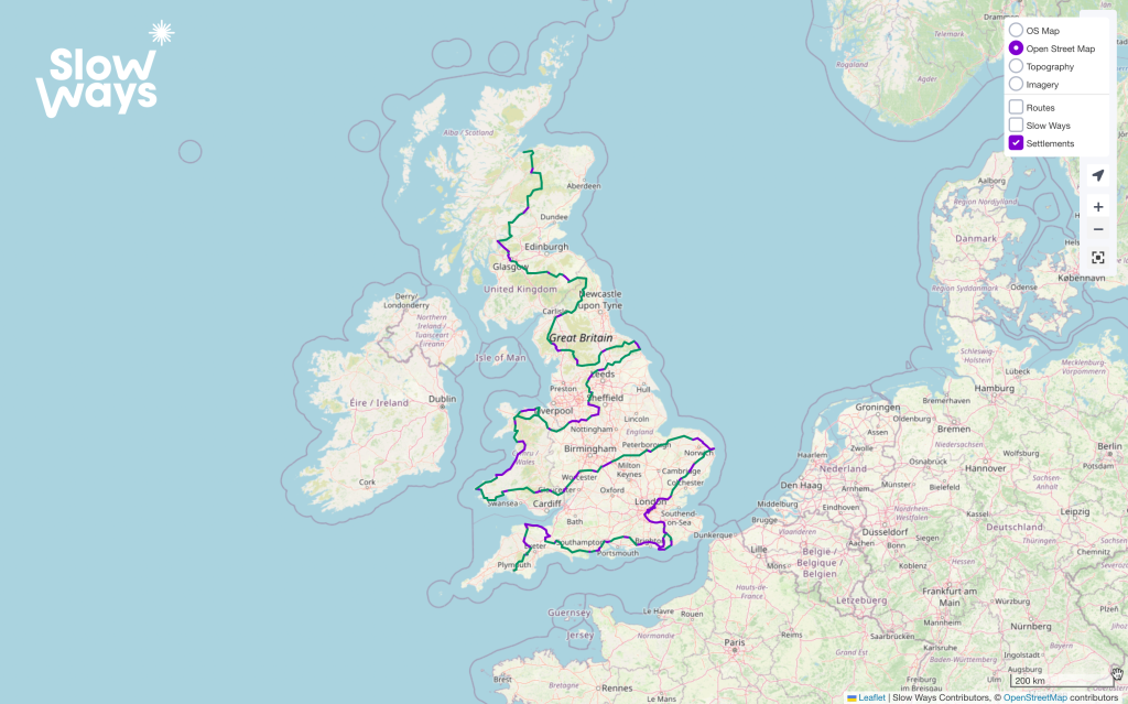
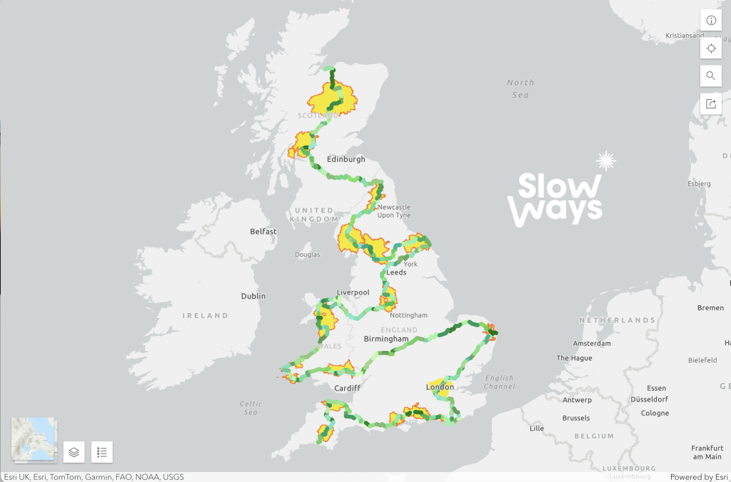
We’ve created maps showing how the trail travels through each National Park.
To help, simply choose a route, walk it, and leave a review on the website.
Once a route has three positive reviews, it’s considered verified.
If you know of another route between two places in the network, you can upload it. If it’s better, we’ll switch it in – or offer it as an alternative.
On the maps below, purple routes are verified. Green routes have been reviewed, often highly, but haven’t yet passed the three-review mark.
The aim is simple: find the best routes, and turn them purple.
Join the National Park Trail Challenge
Slow Ways National Parks Trail
You can suggest changes to the trail by completing this form. And if you are interested in being more involved in shaping or championing part of the National Park Trail locally please drop us an email at [email protected].
The National Parks Trail is a powerful example of what the Slow Ways platform can do – enabling people to share, rate and curate meaningful networks.
We’ve just launched a major crowdfunding campaign to help other groups create their own trails and networks, connecting millions more people and places.
While walking has been our focus, we’re expanding to include running, cycling, and horse-riding – alongside best-in-class options for wheelchair users, scooter riders, and families with pushchairs.
This next step will empower charities, schools, clubs, social enterprises, public sector organisations and more to design routes and networks tailored to their communities.
That means people will be able to follow trusted, community-organisation created and peer-reviewed routes that match their interests and needs.
For seasoned walkers, this might not seem revolutionary. But for someone who needs reliable information to confidently set out – it can make all the difference.
Too many people don’t know the best way to go, so are missing out on active travel, time outdoors and discovering new places because they don’t have access to the routes they want. We can fix that.
Our crowdfunding campaign is intentionally ambitious – but for good reason. We’re designing our new website to make it easy and affordable for community organisations to create their own routes and networks, just as we’ve done with Slow Ways. For just £60 a year, your organisation will be able to build and share a custom walking network tailored to your community. If you’d like to support lots of local organisations across your area to be involved you can organise a local area fundraiser.
Personally, I’d love to see dozens of organisations in every National Park and National Landscape sharing their best local routes for nature, children, heritage, dark skies, art, wheelchair access, and more – all in one easy-to-use place.
This could mean collaboratively creating not just a citizen-made National Parks Trail, but a National Parks, Landscapes & Trails System that better enables more people to enjoy our most highly prized landscapes under their own steam.
Interested to get involved? Here are some links.
While 2025 may have been a difficult year for nature, our supporters have enabled us to rise to the challenges and carve out some significant wins for National Parks.
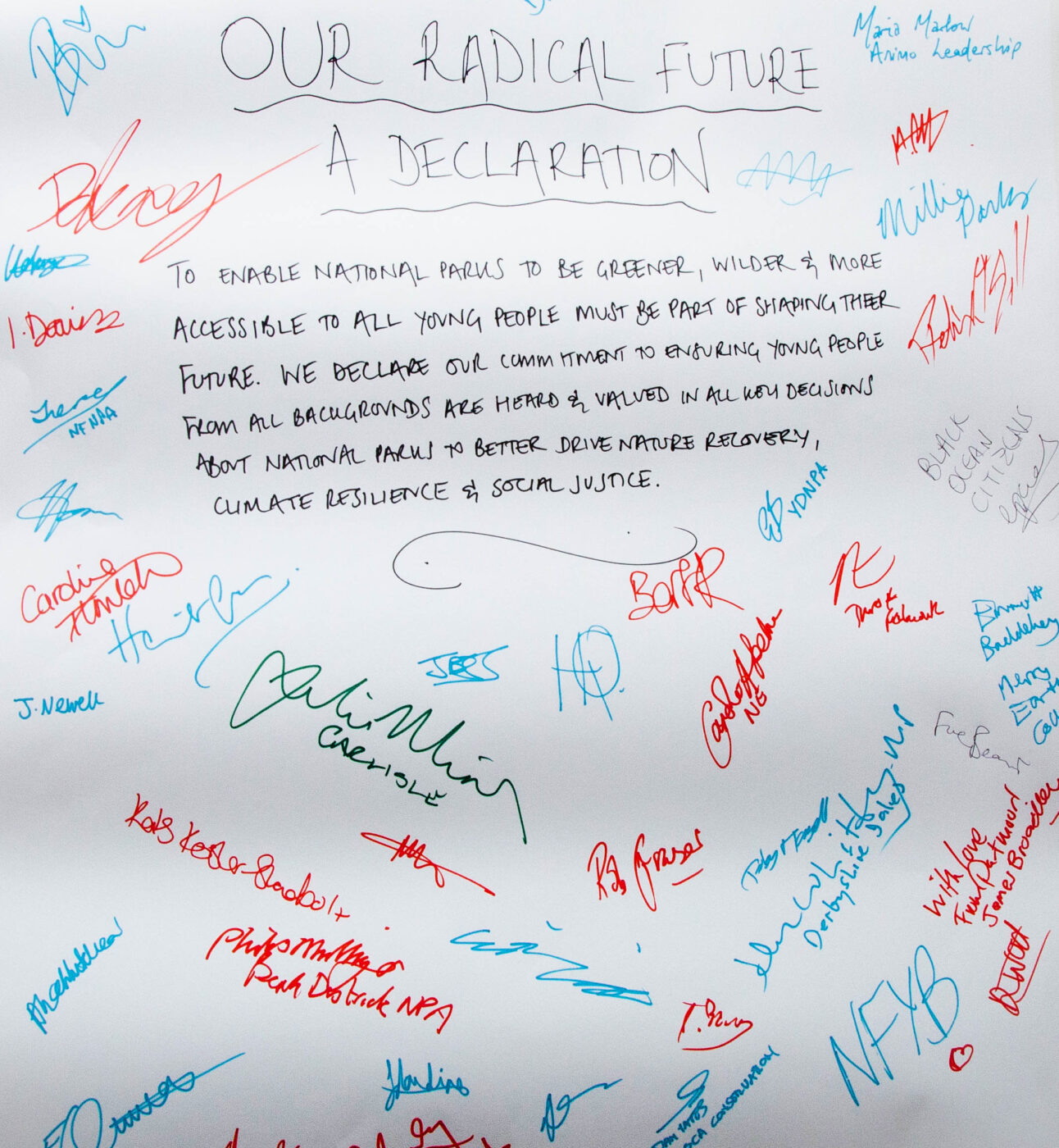
Andrew McCloy, Chair of Trustees at Campaign for National Parks reflects on last week’s uplifting Radical Futures event.
Daniel Raven-Ellison, founder and CEO of Slow Ways, a not-for-profit Community Interest Company, shares a vision for a National Parks Trail and how we can bring it to life.